
At the AWESM Lab, we believe that agriculture and conservation do not need to be competing interests and can coexist. We strive to find innovative ways to balance wildlife and ecosystem conservation with the needs of farmers and ranchers in a predominantly agricultural state. We study wildlife and habitat management from individual land parcels to entire landscapes, specifically in agriculturally dominated areas. Some focus points of our research include integrating wildlife conservation with agriculture systems using landscape ecology and precision conservation.
-
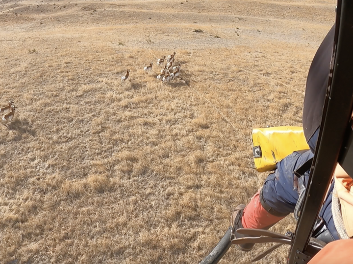 Aerial captures are used to tag pronghorn with GPS units to track their movements across NebraskaAWESM Lab
 -
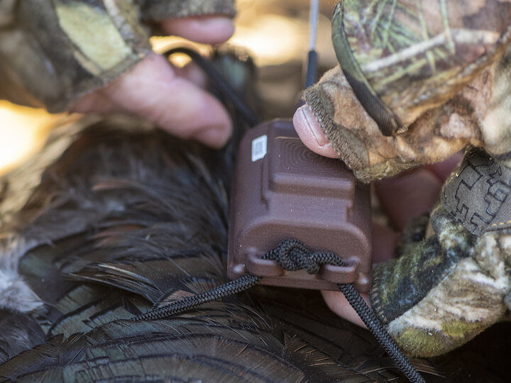 Backpack-style GPS units are used to track wild turkey movements across NebraskaNebraskaland/Nebraska Game and Parks Commission
Integrating Wildlife Conservation with Agricultural Systems Using Landscape Ecology
We provide science-based evidence to improve wildlife and habitat management in agricultural landscapes. We use a whole-scale or landscape approach, which means that the entire landscape is considered. By thinking beyond the patch, we integrate wildlife spatial ecology and landscape structure to find the most effective conservation methods for wildlife while also providing benefits to landowners and producers.
-
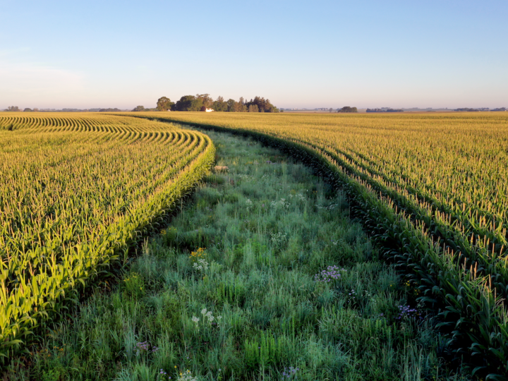 Prairie strips (CP-43) integrate sections of native prairie vegetation into or around row crop fieldsOmar de Kok-Mercado/Iowa State University
 -
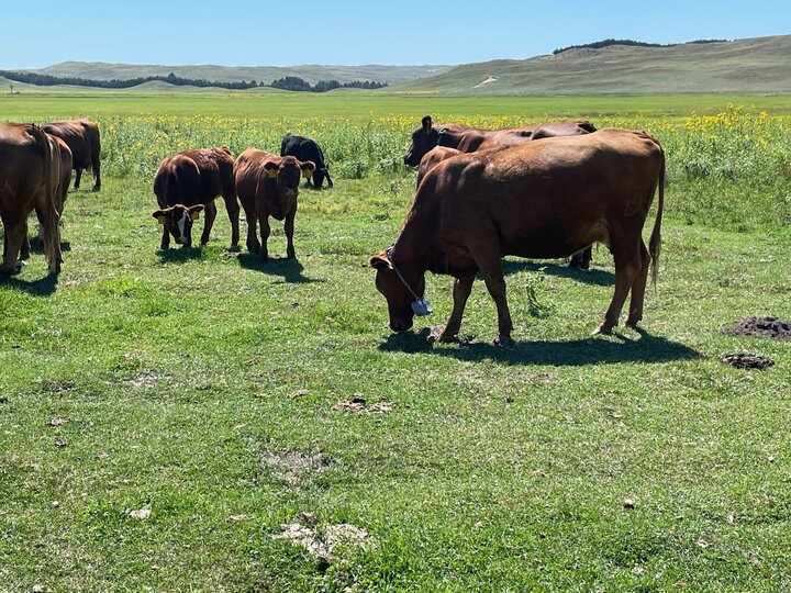 Virtual fencing helps ranchers integrate conservation practices like rotational grazing on their landKaitlyn Dozler/AWESM Lab
Precision Conservation
Precision conservation can create win-win solutions for farmers and landowners to maximize whole-field profitability while reducing the impacts on the environment (e.g., reduced soil erosion, water runoff). Precision conservation is a new method aimed at using spatial tools to:
- Identify opportunities on the landscape for conservation enrollment
- Help land managers improve whole-field profitability by farming the best yielding acres while conserving the marginal, or low yielding, acres